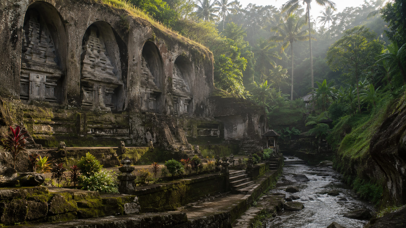
Gunung Kawi in Tampaksiring is unlike most temple sites visitors encounter in Bali. Instead of arriving at a roadside compound and moving directly through a sequence of gates, you descend into the Pakerisan River valley, pass rice fields and reach monumental shrines carved into cliff faces. The setting makes the visit feel archaeological, sacred and intensely connected to the setting at the same time.
The site is often described as an eleventh-century complex associated with the Warmadewa dynasty. Its rock-cut monuments are commonly called candi, but they are not chambers that you enter. They are tall memorial facades carved into the cliff. Understanding that difference prevents one of the most common visitor misunderstandings.
Expect a descent before you reach the monuments
Gunung Kawi requires more walking than many famous Bali temples. The route drops from the entrance area into the valley on a long series of steps, with views across terraced fields and irrigation channels along the way. The walk down is manageable for many visitors, but the return climb can feel much harder in midday heat.
Start early, carry water and wear footwear with grip. Early September is generally still part of Bali’s drier period, which can make the paths more comfortable than during sustained wet-season rain. Even so, shaded stone can remain slippery, and tropical showers are possible in any month.
The candi are carved monuments, not conventional temple towers
The most striking features are the large rock-cut facades on both sides of the river valley. Indonesia’s official tourism site describes them as eleventh-century monuments associated with King Anak Wungsu and the Warmadewa royal family. You can read the official introduction on Indonesia Travel.
Historical interpretations of individual monuments should be presented carefully. Popular guides often assign each candi to a specific royal person with complete certainty, while archaeological interpretation is more nuanced. The safest approach for a visitor is to understand the dynastic context and the memorial character of the complex without treating every traditional identification as proven fact.
The valley matters as much as the carvings
Gunung Kawi would be a very different site if the monuments were displayed in a museum courtyard. Their position beside the Pakerisan River, surrounded by steep vegetation and agricultural land, is central to the experience.
The Pakerisan watershed forms part of the wider cultural setting recognized by UNESCO for the relationship between water, rice cultivation, temples and the Subak system. Gunung Kawi should not be casually described as a stand-alone UNESCO-listed property, but its setting helps visitors understand the broader setting UNESCO discusses in its UNESCO-listed Subak cultural property in Bali.
Do not rush past the active sacred areas
The archaeological monuments draw most of the attention, but Gunung Kawi is also a living religious site. Dress modestly and wear the required sarong and sash. Follow signs around shrines and prayer areas, and do not assume that an ancient-looking structure is only an object for photography.
Some of the site’s pavilions and courtyards will make more sense if you already understand the basic principles of Balinese temple architecture. The rock-cut candi are unusual, but the living temple spaces around them still operate through boundaries, ritual use and local rules.
How to move through the site without losing the experience
A common mistake is to descend quickly, photograph the main monuments and immediately start climbing back. Instead, pause at different levels. The approach through rice fields explains how the valley is used. The river reveals why the site feels secluded. Smaller paths and structures show that the complex is more than one famous cliff face.
Keep to established routes. Do not step onto irrigation channels or cultivated plots for photographs. Rice terraces are working agricultural spaces, not public viewing platforms. If a path looks private or unclear, ask before continuing.
Photography is easiest when you use scale
The monuments are large, and photographs work well when they include people at a respectful distance or show the surrounding cliff and vegetation. Avoid climbing onto bases or restricted areas to remove other visitors from the frame.
The valley can have a large difference in exposure between bright sky and shaded stone, especially later in the morning. A slower visit gives your eyes and camera time to adjust. It also reduces the temptation to block narrow paths while trying to compose a perfect image.
Combine history with humility
Gunung Kawi is often marketed through dramatic phrases such as “Valley of the Kings.” Such labels are memorable, but they can make a complex archaeological site sound more certain and theatrical than the evidence allows. Use them as travel shorthand, not as a substitute for history.
The better way to visit is to accept several layers at once. The candi are remarkable works of rock-cut architecture. The site is tied to an important period of Balinese history. The valley remains part of a living agricultural and sacred setting. Religious use continues around archaeological remains.
By the time you climb back to the entrance, the effort helps explain why Gunung Kawi feels different from a quick temple stop. You have moved physically into the setting rather than simply standing in front of a monument. Give the site enough time, and the relationship between stone, water, farming and worship becomes the most memorable part of the visit.